![](https://images.squarespace-cdn.com/content/v1/6316dc91c3127239ee7a9669/5e515b1d-9520-48d2-87e1-24ab376b2317/Intro_2019_riegl_corp_fade.jpg)
Case Studies
Airborne Laser Scanning
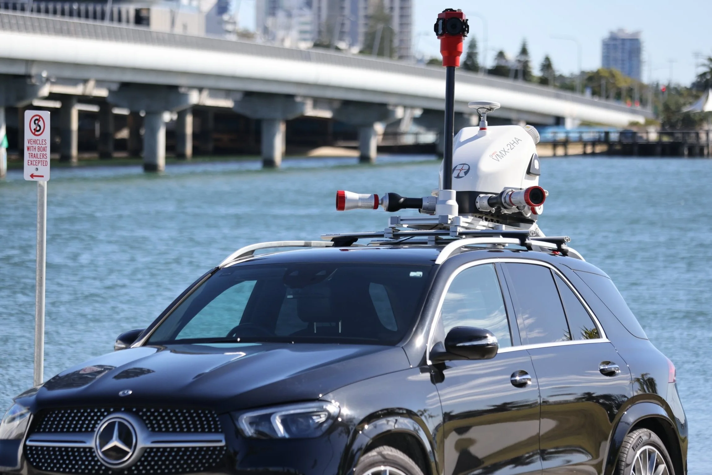
Mobile Laser Scanning
Unmanned Laser Scanning
Terrestrial Laser Scanning
![Innoflight Technology](https://images.squarespace-cdn.com/content/v1/6316dc91c3127239ee7a9669/1689138622812-V2THB9QKVQRQ10KR29PO/0N1A3943.jpg)
Innoflight Technology
Innoflight Technology with Riegl Australia - Operating the NEW VUX-160 from a petrol/electric hybrid drone
![Measure Australia | CitiSurv Land Surveyors](https://images.squarespace-cdn.com/content/v1/6316dc91c3127239ee7a9669/1688356264898-0I60WZA6PPCJOZMH558D/MA_profile.jpg)
Measure Australia | CitiSurv Land Surveyors
CitiSurv Land Surveyors - Sackville North, NSW miniVUX-SYS drone LiDAR survey
![Bennett + Bennett](https://images.squarespace-cdn.com/content/v1/6316dc91c3127239ee7a9669/1667973880137-FEMH0DGPFWOIEQ83U4CG/Blog-Image-Tile-stockmans-survey.jpg)
Bennett + Bennett
Capturing the Australian outback with the latest drone LiDAR technology