Case Studies

Airborne Laser Scanning
Mobile Laser Scanning


Unmanned Laser Scanning

Terrestrial Laser Scanning

Arbormeta
Arbormeta utlise laser scanning technology to combat environmental crises
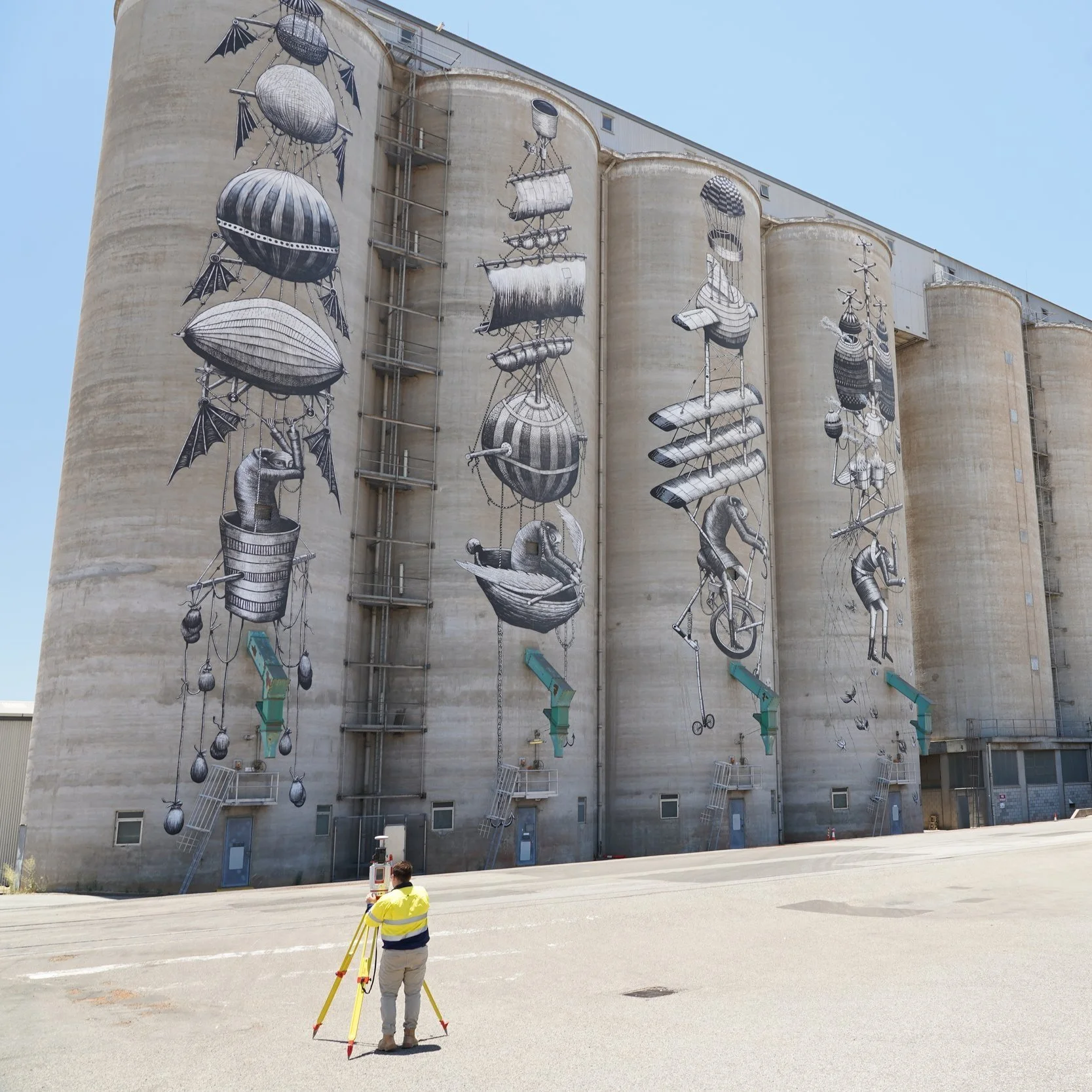
RM Surveys
Detailed laser scan of CBH Group's main grain terminal in Western Australia

Royal Australian Navy
Royal Australian Navy Trial Bathymetric Lidar Sensor During Exercise Sea Raider

Milford Road Alliance
Topographic mapping for snow avalanche hazard modelling

Bennett + Bennett
Landslide sites surveyed and monitored for subsidence using Riegl LiDAR in Tweed Shire, NSW
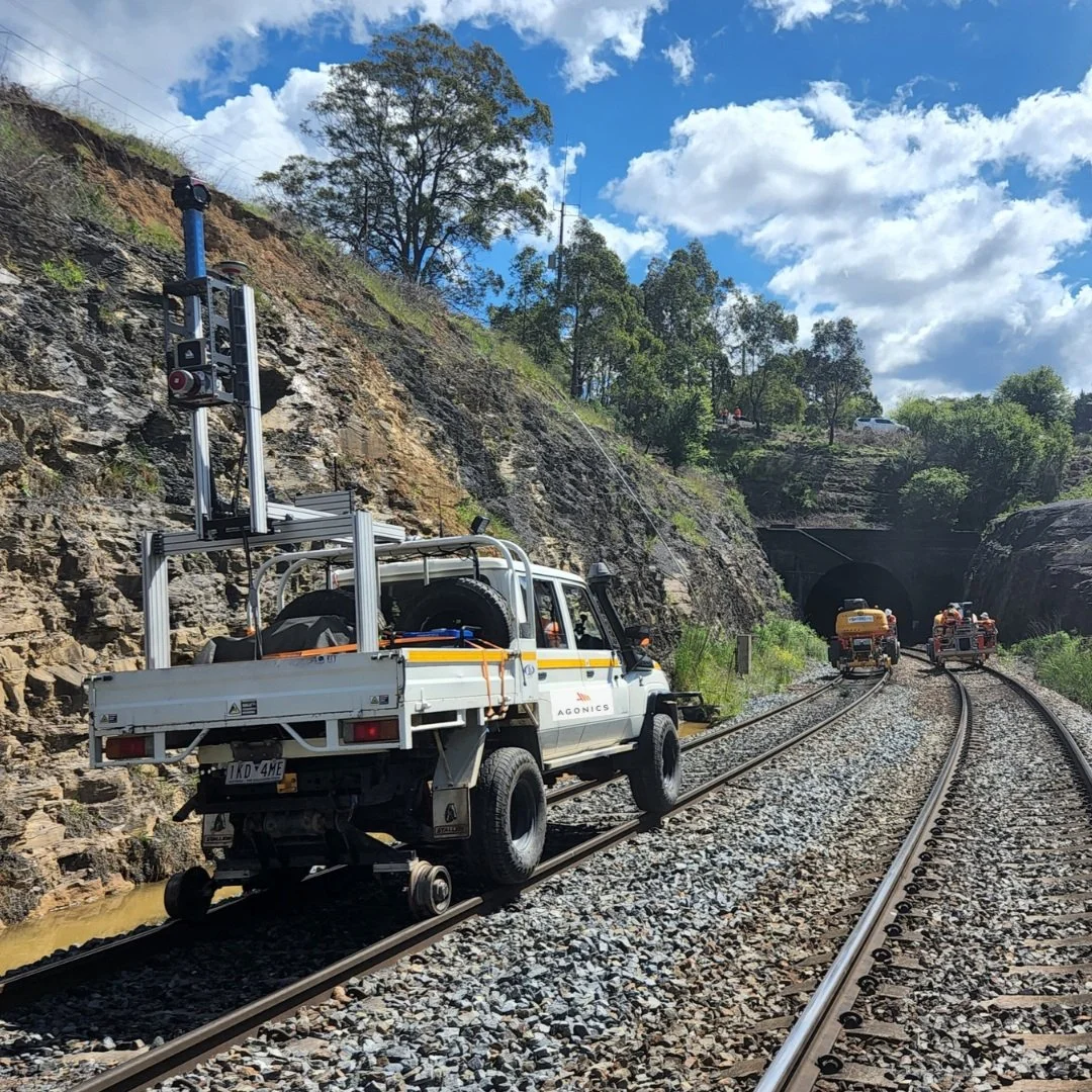
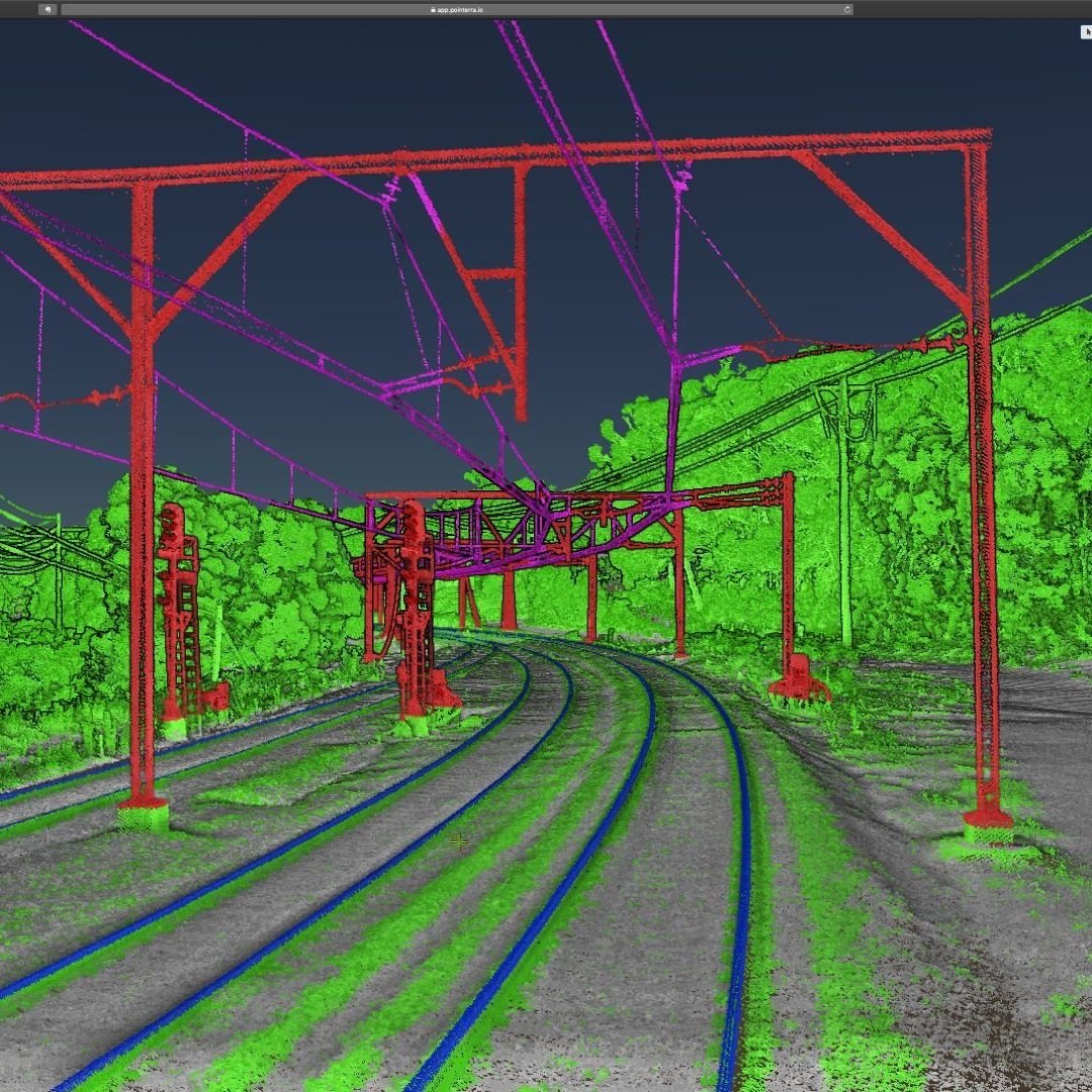
Agonics
Agonics executes network wide mobile laser scanning (MLS) projects across iconic railway networks including ARTC, Metro Trains, V/Line, TasRail and Sydney Trains

University of Canterbury
Scientists use LiDAR to map environmental impact following an extreme weather event in New Zealand

Innoflight Technology
Innoflight Technology with Riegl Australia - Operating the NEW VUX-160 from a petrol/electric hybrid drone

Measure Australia | CitiSurv Land Surveyors
CitiSurv Land Surveyors - Sackville North, NSW miniVUX-SYS drone LiDAR survey

MNG
MNG has been contracted by Main Roads Western Australia to map the network of footpaths using LiDAR and imagery to inform safety star rating as part of the National Road Safety Action Strategy
Aerometrex
World’s first bushfire fuel load mapping system using Riegl LiDAR technology

ESO Surveyors
ESO Surveyors use the RIEGL VZ-400i laser scanner to generate highly detailed 3D digital twin models of transportation and utility corridors

Altavec
Altavec uses LiDAR and AWS Machine Learning for bushfire prevention

Altavec
Altavec uses LiDAR and AWS Machine Learning for bushfire prevention

Jacobs | CSIRO
Scanning The Wreck Of The SS Lake Illawarra

Endeavour Energy
Vehicle-mounted LiDAR takes to the streets

MNG
Kings Park Feature Survey using mobile and airborne laser scanning

Land Surveys
RIEGL VMQ-1HA and miniVUX-SYS (MLS and ULS) LiDAR systems used for 3D mapping in Australia
Jacobs
VMX-450 Blue Mountains MLS - Kinematic Envelope Assessment

Insitu Pacific
Collecting critical business intelligence for Mining Exploration