Beon Aerial
LiDAR on powerlines to locate encroaching vegetation and prevent bushfires in Victoria
Our aerial vegetation inspection program is a key part of how we keep our networks safe and reliable for our customers.
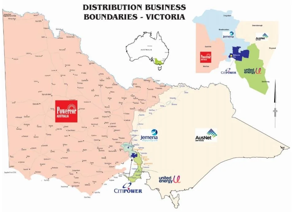
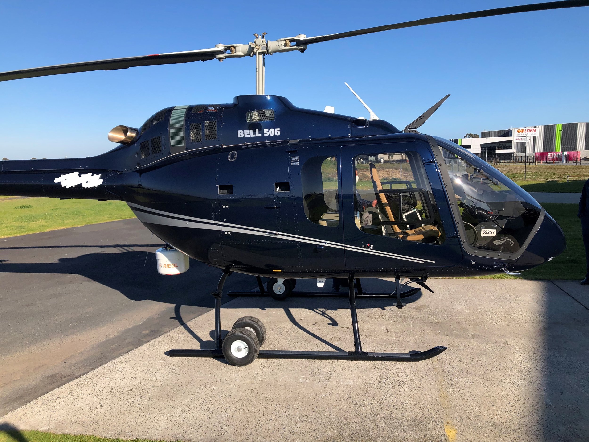
Two Bell 505 helicopters, combined with industry-leading technology, establish a unique aerial services capability to support Powercor/CitiPower/United Energy's annual vegetation management program.
Headed up by a team of highly-qualified pilots, the helicopters are fitted with Riegl sensor systems, which uses LiDAR scanning technology to accurately measure the distance between any tree branches or other vegetation and the electricity network.
The data creates a 3D image of the entire network and this is analysed by an internal team of highly-qualified data analysts to help inform Powercor/CitiPower/United Energy's annual tree-cutting schedule.
Each time the network is inspected, more is learned about the different environmental conditions and vegetation growing rates across the region.
This data helps ensure we identify precisely which trees to cut, by how much and when.
The helicopters, which fly above powerlines at just over 300 metres at a speed of about 130kmh, operate all year round.
Fast facts – the fleet
Aircraft: Bell 505 helicopters
Fleet size: Two aircraft
Crew: Two pilots per aircraft
Top speed: 232km/h
Slow cruise speed for LiDAR capture: 129km/h
Range: 617km
Aircraft length: 12.93m
Aircraft height: 3.25m
LiDAR system: RIEGL VUX-240
LiDAR scan speed: 1.8MHz and 400 lines per second
Data capture: 1TB per aircraft per day