Case Studies

Airborne Laser Scanning
Mobile Laser Scanning


Unmanned Laser Scanning

Terrestrial Laser Scanning
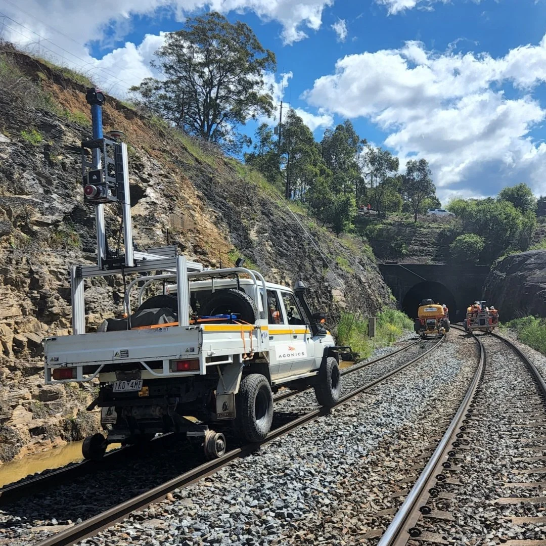
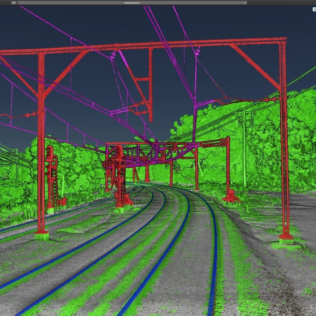
Agonics
Agonics executes network wide mobile laser scanning (MLS) projects across iconic railway networks including ARTC, Metro Trains, V/Line, TasRail and Sydney Trains

MNG
MNG has been contracted by Main Roads Western Australia to map the network of footpaths using LiDAR and imagery to inform safety star rating as part of the National Road Safety Action Strategy

Altavec
Altavec uses LiDAR and AWS Machine Learning for bushfire prevention

Jacobs | CSIRO
Scanning The Wreck Of The SS Lake Illawarra

Endeavour Energy
Vehicle-mounted LiDAR takes to the streets

MNG
Kings Park Feature Survey using mobile and airborne laser scanning

Land Surveys
RIEGL VMQ-1HA and miniVUX-SYS (MLS and ULS) LiDAR systems used for 3D mapping in Australia
Jacobs
VMX-450 Blue Mountains MLS - Kinematic Envelope Assessment