Case Studies

Airborne Laser Scanning
Mobile Laser Scanning

Unmanned Laser Scanning

Terrestrial Laser Scanning
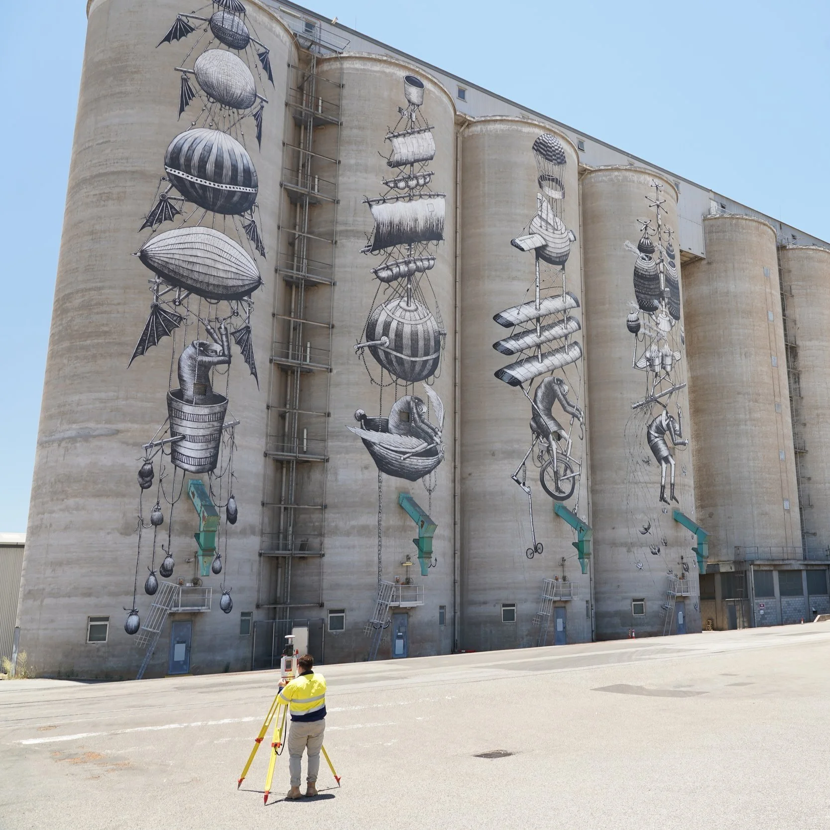
RM Surveys
Detailed laser scan of CBH Group's main grain terminal in Western Australia

Royal Australian Navy
Royal Australian Navy Trial Bathymetric Lidar Sensor During Exercise Sea Raider

Milford Road Alliance
Topographic mapping for snow avalanche hazard modelling

Bennett + Bennett
Landslide sites surveyed and monitored for subsidence using Riegl LiDAR in Tweed Shire, NSW

Innoflight Technology
Innoflight Technology with Riegl Australia - Operating the NEW VUX-160 from a petrol/electric hybrid drone

Measure Australia | CitiSurv Land Surveyors
CitiSurv Land Surveyors - Sackville North, NSW miniVUX-SYS drone LiDAR survey

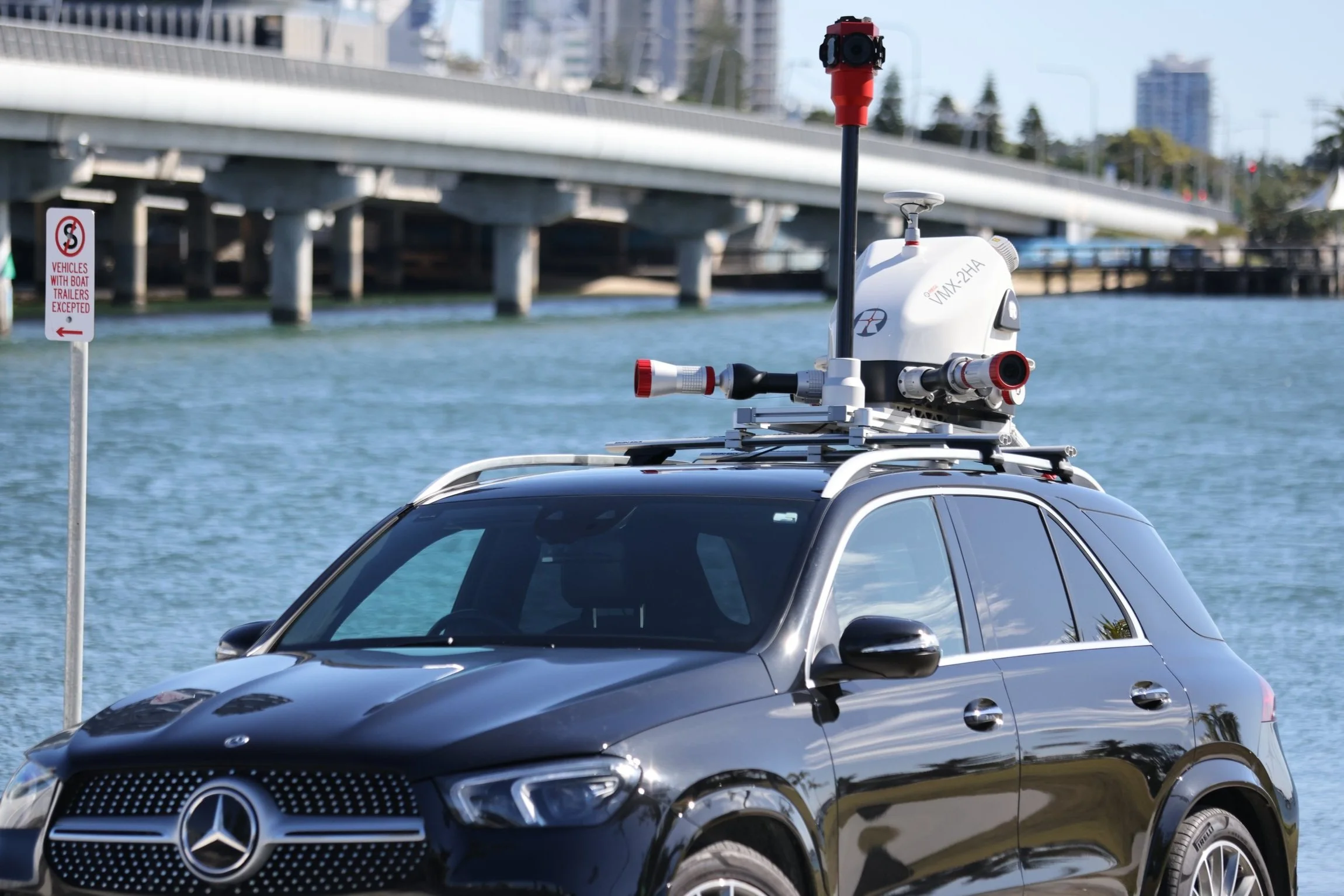
Land Surveys
RIEGL VMQ-1HA and miniVUX-SYS (MLS and ULS) LiDAR systems used for 3D mapping in Australia
Jacobs
VMX-450 Blue Mountains MLS - Kinematic Envelope Assessment

Insitu Pacific
Collecting critical business intelligence for Mining Exploration

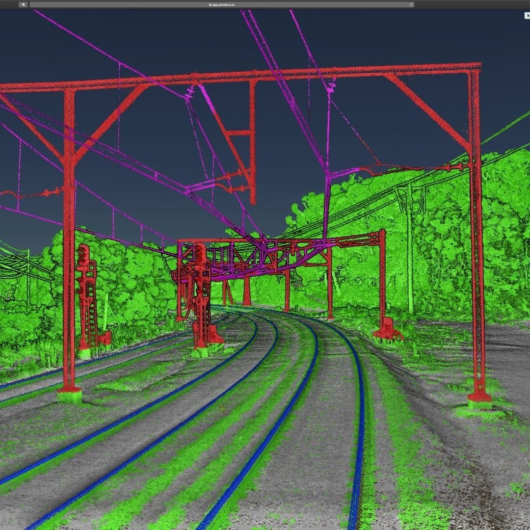
Gertzel
Detailed laser scan of a rail corridor including surrounding road networks and terrain

Dept. of Environment (Qld)
Monitoring gully erosion in Great Barrier Reef catchments

Denada
Improving the delivery of Lidar data over Tailings Storage Facilities in the Australian mining sector

Bennett + Bennett
Capturing the Australian outback with the latest drone LiDAR technology