Case Studies

Airborne Laser Scanning
Mobile Laser Scanning


Unmanned Laser Scanning

Terrestrial Laser Scanning

Gertzel
Detailed laser scan of a rail corridor including surrounding road networks and terrain

Dept. of Environment (Qld)
Monitoring gully erosion in Great Barrier Reef catchments

Denada
Improving the delivery of Lidar data over Tailings Storage Facilities in the Australian mining sector

Bennett + Bennett
Capturing the Australian outback with the latest drone LiDAR technology
Aerometrex
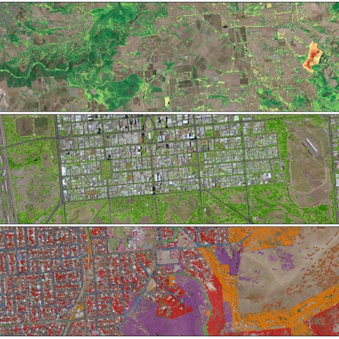
Urban Tree Canopy Management and LiDAR

Airborne Research Australia
LiDAR bathymetry of Ningaloo Reef NW-Western Australia

Airborne Research Australia
Topographic airborne LiDAR survey over bush fire ravaged land in South Australia

Beon Aerial
LiDAR on powerlines to locate encroaching vegetation and prevent bushfires in Victoria, Australia